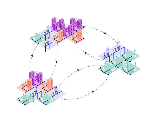
5. Local authority commitment: generating demand and de-risking delivery
Align financial models with the local population
ALPHA
Section objective
To provide the socio-economic 'intelligence' that allows businesses to align their financial models (eg, grant-funded vs. private finance) with the local population. It proves the council isn't just handing over a technical map, but is actively managing the customer pipeline. While section four showed the what and where, section five explains the 'ease of sale.' This section acts as a data source for stakeholders to cross reference the opportunity areas in the previous section.
The value to stakeholders
Strategic market segmenting: the index of multiple deprivation (IMD) deciles and tenure mix is a roadmap for a company’s sales team. A high concentration of social housing signals a 'bulk procurement' and funding opportunities for large firms, while pockets of owner-occupiers signal a 'retail opportunity' for local installers to use individual grants like the BUS.
Operational delivery and quality: sharing property readiness data signals to the supply chain exactly where they can deploy a 'heat-pump-only' crew versus where additional work is needed, ensuring the technology actually works and protecting the council's reputation from suboptimal installations.
Pipeline certainty: leading with a comprehensive data set signals that the council is a 'sophisticated client'. This transparency encourages the supply chain to invest in local skills and recruitment because they can see a clear, long-term work volume.
What to include in this section
To make this a functional tool for supply chain stakeholders, this section should be presented as a data directory. This section should provide socio-economic data to highlight fuel poverty and grant eligibility, as well as provide stakeholders with the 'local nuances and characteristics' of the area.
Missing data: Be honest about missing data. This helps contractors price in 'discovery risk.' Alternatively, the council might want to collect additional data to provide a more accurate estimate for the area.
Socio-economic data and vulnerability
Data check list:
IMD deciles
Tenure mix
Insight: Identifies the 'customer' (social landlord vs. homeowner) and grants eligibility.
Why to include: De-risks delivery by aligning the project with existing national funding streams.
Physical reality
Data check list:
Construction year
Housing type
Listed status and conservation area
Insight: Predicts installation complexity and technical archetypes (eg, solid walls vs. cavities).
Why to include: Reduces 'discovery risk' and allows contractors to estimate work needed more accurately, even before site visits.
Energy baseline
Data check list:
EPC data
Solar panels
Off-gas status
Insight: Indicates 'property readiness' and potential for packaged solutions (eg, heat pump + solar).
Why to include: Demonstrates the immediate viability of the heat transition for specific clusters in the area.
Site logistics
Data check list:
Roads, river and railways
Salt exposure
Public greenspaces
Insight: Identifies physical access constraints and hardware durability requirements (eg, anti-corrosion).
Why to include: Flags early operational hurdles that could cause delays or equipment failure if not planned for.
Commercial anchor
Data check list:
Heat network zones
Anchor loads
Social housing sites
Insight: Signals high-volume, stable thermal demand from large buildings (schools/colleges).
Why to include: Proves the project has the 'base load' required to make large-scale networked infrastructure viable.
Example text
This box below includes a pre-written section that can be filled in with information relevant to your chosen area.
5. Our commitment: Generating demand and de-risking delivery
This section provides key data designed to help you forecast demand, reduce commercial risk, and tailor your delivery plans.
5.1. Building a customer pipeline grounded in local context
Our priority is to ensure that this clean heat plan is grounded in the local context, not solely on technology. It must integrate critical socio-economic and property data to ensure that heat pathways are both technically viable and responsive to household needs, with a focus on safeguarding consumers against suboptimal or unaffordable technology choices, helping ensure a just transition, particularly for those in fuel poverty. In some cases, optimal installation may include packaged solutions, including heat pumps, solar, storage and relevant electricity tariffs.
5.1.1. Data and technical suitability
To inform supply chain involvement, COUNCIL NAME gathered the following estimates:
Socio-economic data and vulnerability
IMD deciles
Tenure mix
Property readiness
EPC data
Construction year
Housing type
Off- and on-gas properties
Solar panels
Listed buildings and conservation areas
AREA characteristics
Exposure to salt
Public greenspace
Roads, river and railways
Heat network zones
Anchor load properties
Socio-economic data and vulnerability
IMD deciles
The Index of Multiple Deprivation (IMD) is a key factor influencing the required approach and funding pathways for the decarbonisation effort. Map 2 illustrates the IMD deciles across AREA's Lower-Layer Super Output Areas (LSOAs), utilising 2025 data from the Ministry of Housing, Communities & Local Government, with decile 1 representing the most deprived areas and decile 10 the least. The map shows that AREA is an area of OVERALL LEVEL OF DEPRIVATION, which should be taken into account.
This data directly informs our strategy, as higher deprivation levels often correlate with increased eligibility for national and regional grant funding streams and most importantly a greater need for energy efficiency and heat decarbonisation measures to combat fuel poverty.
Map 2. IMD deciles across AREA's Lower-Layer Super Output Areas (LSOAs). Source: Ministry of Housing, Communities & Local Government 2025 data.
INSERT MAP
Tenure mix (social, private rental, owner-occupier)
The tenure mix across AREA directly influences business development, procurement routes, financing models, and the scalability of delivery. Map 3, informed by Council data, visualises the distribution of owner-occupied, social rented, and private rented properties across AREA. Map 3 shows that AREA has a SHARE OF OWNER-OCCUPIERS (PERCENTAGE), but a SHARE OF RENTERS, EITHER PRIVATE OR SOCIAL (PERCENTAGE and PERCENTAGE respectively). Note that there is missing data for PERCENTAGE of households in the area. In this case, missing data may imply that this PERCENTAGE share of homes in AREA are owner-occupier, bringing the total to PERCENTAGE, and have not had a change of occupants in NUMBER years, since EPCs were introduced as mandatory for residential property sales and rentals in YEAR, and that these homes are also not social housing.
Stakeholders should note that a high concentration of social housing offers immediate opportunities for aggregated, long-term contracts with anchor partners, such as social landlords, providing confirmed, large-scale demand ideal for factory orders and workforce training. Conversely, areas dominated by owner-occupied or private rented homes require strategies focused on individual customer acquisition, grant administration support, and a greater reliance on local installer networks. This map aims to allow you to tailor your sales pipeline, allocate installation teams, and align your production capacity with the most active and accessible demand segments.
Map 3. Tenure type across AREA. Source: Department for Levelling Up, Housing & Communities. (2025). Energy Performance of Buildings Data: England and Wales. Energy Performance of Buildings Search Results
INSERT MAP
Property readiness
EPC data
The Energy Performance Certificate (EPC) data provides information about energy efficiency of the housing stock, directly impacting the scope and complexity of the required retrofit work. Map 4 illustrates the distribution of EPC ratings (A-G) across AREA, offering a clear signal of where deep retrofit interventions will be necessary. Based on available data, most EPC ratings for dwellings in AREA sit between EPC RATINGS, with NUMBER homes with EPC D. Based on available data, around NUMBER dwellings have an EPC score lower than E. Note that data is missing for NUMBER dwellings (around PERCENTAGE of homes in the area).
For manufacturers and skills providers, this data highlights the need for careful heating systems designs and quantifies the demand for materials such as high-specification insulation and the need for accredited installers trained in whole-house retrofit. Areas with a high concentration of low ratings (E, F, G) represent the highest potential for immediate energy savings and are most likely to require fabric measures before the installation of heat pumps. This insight is aimed at enabling you to target investment in specific product lines and upskilling programmes that align with the most pressing technical challenges identified in AREA.
Map 4. Energy efficiency ratings across AREA. Source: EPC register. Source: Department for Levelling Up, Housing & Communities. (2025). Energy Performance of Buildings Data: England and Wales. Energy Performance of Buildings Search Results
INSERT MAP
Construction year
The age and construction period of the housing stock is a useful indicator for technical feasibility and cost estimation for all supply chain stakeholders. Map 5 illustrates the distribution of properties by their construction year, providing an indication of the original building standards. Most dwellings in AREA are RECENT/OLD: at least NUMBER dwellings were built before YEAR (PERCENTAGE of dwellings for which we have data on construction year). Map 6 shows the type of wall construction.
For installers and retrofit coordinators, this data signals:
Pre-1919/Traditional builds: These properties often require careful sizing of heat pumps due to higher heat losses and may need specialist components or heating system designs.
Post-1990 builds: These generally offer a more straightforward and lower-cost heat pump installation due to better thermal performance and smaller heat losses, which might allow for a simpler system design and quicker installation.
These maps aim to allow manufacturers and training providers to focus on the specialised skills required for retrofitting the dominant building type in AREA.
Map 5. Housing stock age across AREA. Source: Department for Levelling Up, Housing & Communities. (2025). Energy Performance of Buildings Data: England and Wales. Energy Performance of Buildings Search Results
INSERT MAP
Map 6. Wall construction type across AREA. Source: Department for Levelling Up, Housing & Communities. (2025). Energy Performance of Buildings Data: England and Wales. Energy Performance of Buildings Search Results
INSERT MAP
Housing type
The housing and attachment type data provides essential context for the technical design and efficient execution of retrofit projects. Map 7 illustrates the distribution of housing types (e.g., house, flat, maisonette), while Map 8 details the attachment types (e.g., detached, semi-detached, mid-terrace). For its majority, AREA is composed of MOST COMMON HOUSING TYPE. Map 7 shows that NUMBER dwellings (PERCENTAGE) in AREA are houses, NUMBER are flats (PERCENTAGE), while NUMBER (PERCENTAGE) and NUMBER (PERCENTAGE) are maisonettes and bungalows respectively. Map 8 shows that these are primarily on terraced streets: NUMBER dwellings (PERCENTAGE) are either mid-terraces or end-of-terraces.
For installers and retrofit coordinators, these maps can be used to help define the technological options, scale of installation and the required access solutions:
Individual heat source (e.g., air or ground source heat pumps): The space and property ownership structure typically simplify the installation of an external unit and internal components. This segment signals high demand for standard residential ASHP units and accompanying ancillary equipment.
Communal heat source (within a single building) / Shared ground loop: This is the preferred pathway for flats and maisonettes within single blocks, especially those owned by social landlords or managed by one freeholder. Communal systems overcome space constraints for individual units and allow for aggregated efficiency gains and maintenance. Supply chain focus here should be on commercial-scale plant equipment.
Heat networks: High-density areas, particularly those with clusters of mid-terrace houses and social housing blocks, present the greatest commercial opportunity for a new or extended heat network. The proximity of buildings and the potential for a large, confirmed heat load from anchor partners (including the Council's building stock and the social housing owned by SOCIAL HOUSING PROVIDERS IN THE AREA) de-risks the investment required for the pipe network.
This combined data allows manufacturers to accurately forecast best fit and demand for products tailored to high-density terraced streets and helps skills providers focus training on the most prevalent architectural challenges in AREA.
Map 7. Housing type across AREA. Source: Department for Levelling Up, Housing & Communities. (2025). Energy Performance of Buildings Data: England and Wales. Energy Performance of Buildings Search Results / Ordnance Survey National Geographic Database (NGD) – Buildings Theme: OS NGD Buildings | OS National Geographic Database
INSERT MAP
Map 8. Type of housing across AREA. Source: Department for Levelling Up, Housing & Communities. (2025). Energy Performance of Buildings Data: England and Wales. Energy Performance of Buildings Search Results / Ordnance Survey National Geographic Database (NGD) – Buildings Theme: OS NGD Buildings | OS National Geographic Database
INSERT MAP
Heating type and off- and on-gas properties
The existing heating system data defines the immediate technical scope and decommissioning requirements of the project, directly influencing the installer skillsets and removal logistics you'll need. Map 9 illustrates the predominant heating fuel types currently in use across AREA (e.g., mains gas, electricity, oil). Most dwellings in AREA are currently heated with HEAT SOURCE (e.g., gas boilers): at least NUMBER homes (PERCENTAGE).
The map identifies areas reliant on mains gas, which will require the bulk of the work to be focused on like-for-like replacement of fossil fuel boilers with heat pumps or heat network connections. Crucially, the map also highlights any clusters of off-gas properties (e.g., those using oil, LPG, or electric-only heating). These off-gas zones represent areas where cost-savings and carbon reductions are often greatest, making them prime candidates for early intervention. Installers should use this data to forecast the types of associated works required (e.g., removal of oil tanks) and ensure their teams are proficient in both gas system decommissioning and the subsequent low-carbon technology installation.
Map 9. Predominant heating fuel types currently in use across AREA. Source: Department for Levelling Up, Housing & Communities. (2025). Energy Performance of Buildings Data: England and Wales. Energy Performance of Buildings Search Results
INSERT MAP
Solar panels
Across AREA, NUMBER/SHARE OF DWELLINGS have solar panels installed. Map 10 shows existing solar installations across AREA, and Map 11 overlays this with the Council's recommended clean heat technology. The solar PV installation data provides a clear signal of energy-ready homes and directly identifies opportunities for system integration.
De-risked heat pump sites: Properties with existing solar PV are attractive because the panels can power the electric heat pump, significantly reducing the resident's running costs and addressing a primary barrier to heat pump uptake. This overlap identifies sites where the financial case for an individual heat pump (ASHP/GSHP) is strongest and requires minimal upfront electrical work.
Targeted upskilling: The map highlights a clear opportunity for MCS certified installers who can offer bundled 'solar-plus-heat' packages. Skills providers should note the demand for training that focuses on the integration of these two technologies, including battery storage and smart controls, to maximise self-consumption of renewable energy.
Stakeholders may choose to prioritise engaging with property owners in the PV-dense areas identified on the maps, as they may represent the most receptive and financially prepared segment for the Council's clean heat transition.
Map 10. Existing solar installations across AREA. Source: data is taken from Google Earth.
INSERT MAP
Map 11. Existing solar installations overlaid with the recommended low-carbon heat technologies across AREA.
INSERT MAP
Listed buildings and building conservation areas
The listed buildings and conservation areas data defines statutory planning and technical constraints that directly impact project scope, cost, and timelines. A SIZE OF THE AREA sits in a conservation area with listed buildings scattered across the area. Map 12 delineates the boundaries of conservation areas and the location of individual listed buildings across AREA. This signals a guaranteed demand for specialist contractors proficient in working with traditional and historic building fabric.
Any modification (external or internal) that affects the character of a Listed Building as a building of special architectural or historic interest requires Listed Building Consent (LBC) prior to the commencement of works. There are also some restrictions on certain types of development within conservation areas and where heritage assets are concerned.
Professional advice from a heritage specialist should therefore be obtained at the outset. Early engagement with the Council’s Historic Environment Officers via the pre-application planning service is available to support you in this process.
Map 12. Building conservation and listed buildings in AREA. Sources: Conservation areas and listed buildings.
INSERT MAP
AREA characteristics
Coastal proximity and salt exposure (REMOVE THIS SECTION IF NOT A COASTAL AREA)
The coastal proximity and salt exposure data informs the specification and durability requirements for all external equipment. CITY being a coastal city, SHARE OF AREA lies within 1.5km of the seafront. Map 13 highlights areas within approximately 1.5km of the coastline in blue, based on the Mean High Water Mark full resolution country boundaries clipped to the coastline, indicating zones subject to increased salt-laden air. Salt exposure accelerates corrosion and wear on metals, which is critical for equipment like ASHP external units, pipework, and mounting brackets. For projects within the blue-shaded areas, stakeholders must mandate the use of:
Marine-grade or anti-corrosion treated components: Manufacturers should specify units with highly resistant coatings or materials (e.g., specific aluminium alloys, coated steel or plastic enclosure).
Enhanced maintenance schedules: Installers should ensure their quoted operational and maintenance contracts reflect the need for more frequent checks, treatment and cleaning in these corrosive environments.
This technical constraint directly impacts the long-term reliability, and warranty claims of installed systems, requiring a proactive adjustment to standard product selection and service offerings.
Map 13. Coastal proximity and salt exposure in AREA. Source: 2024 Mean High Water Mark full resolution country boundaries clipped to the coastline.
INSERT MAP
Public greenspace
Map 14 illustrates the location and extent of publicly owned parks, green areas, and open spaces. Crucially, the utilisation of public green spaces for infrastructure requires careful consideration of statutory planning constraints, particularly related to land use, environmental impact, and securing necessary permissions, alongside proactive community consultation to manage public access and minimise disruption.
Enabling shared ground loop / heat network infrastructure: These spaces are often the most viable and cost-effective locations for deploying the ground arrays (boreholes/trenches) required for shared ground loop or the large-scale pipework required for heat networks. Leveraging public land minimises the cost, complexity, and disruption associated with trenching in roads or private gardens. Car parks may also offer good potential locations for this type of infrastructure.
Signalling low-cost heat source potential: The concentration of accessible ground beneath these parks provides a natural, secure, and potentially high-volume geothermal heat source. This signals a key opportunity for GSHP manufacturers and specialist drilling/geothermal contractors to engage with the Council on large, consolidated infrastructure projects.
Stakeholders should use this map to identify areas where high-density housing (identified in the Tenure map) borders a large green space, as these represent the most commercially and technically viable areas for scalable, low-carbon heat network deployment. Note that inclusion of this information does not in any way suggest that COUNCIL NAME will permit installation of equipment in any particular case.
Map 14. Public green spaces in AREA (excluding allotments and play spaces). Source: OS Open Greenspace.
INSERT MAP
Please note that Map 14 shows 11 green spaces and some might not be public green spaces. Available data includes allotments and playing fields which may be private. The greenspaces in AREA include a variety of functions as displayed in Table 2.
Table 2. Distribution of green spaces in AREA by type of usage. Source: OS Open Greenspace.
Green space use | Count |
Playing field | NUMBER |
Public park or garden | NUMBER |
Other sports facility | NUMBER |
Total | NUMBER |
Roads, rivers, and railways
Map 15 highlights major transport corridors and waterways across AREA.
Logistical barriers: Major roads, railways, and rivers represent physical constraints for heat networks and shared ground loop deployment. These can substantively increase excavation complexity and cost. Installers and network developers must factor these constraints into project pricing and scheduling, acknowledging the potential for significant delays at these specific pinch points.
Heat source opportunities (rivers): Conversely, major rivers are also a known potential source for water source heat pumps (WSHPs), representing a low-carbon heat source for dense urban areas near the water. This signals an opportunity for manufacturers and specialist contractors to explore commercial viability for anchor loads in proximity to the river.
This map is critical for pre-application planning and risk mitigation, allowing stakeholders to identify the major infrastructural challenges and opportunities before ground is broken.
Map 15. Major transport corridors and waterways across AREA. Source: OS OpenMap Local. Layers used are: roads, surface water area, tidal water, and railway tracks. Major roads include: A and B roads, primary roads, dual carriageways, shared use carriageways and motorways.
INSERT MAP
Heat Network Zones (REMOVE IF NOT CONCERNED BY DESNZ HEAT NETWORK ZONES)
Map 16, taken from the DESNZ Heat Network Zoning pilot programme, delineates priority zones and potential zones for a heat network within the CITY local authority area, including AREA. These zones are identified as areas where heat networks are projected to be the most cost-effective and technically viable long-term decarbonisation solution for homes and businesses. The heat network zones provide a signal from the central government regarding future policy direction and investment priority.
For network developers and investors, this is a direct indication of where future mandates to connect may be applied, offering guaranteed, de-risked demand. Suppliers could use this map to focus large-scale infrastructure investment, secure long-term financing, and prepare supply chains for the volume demand of pre-insulated pipework, central plant components, and associated metering and billing systems within these specific geographic areas.
Please note: these zonal boundaries are subject to ongoing refinement and are correct at time of publication.
Map 16. DESNZ heat network zones in AREA. Source: Heat Network zone opportunity report.
INSERT MAP
Anchor load properties
Anchor load properties data informs the commercial viability of scalable communal clean heat infrastructure, particularly heat networks. Identified using the Overture Maps Foundation’s Point of Interest data, these properties (including hospitals, large educational facilities, and public service/government offices) are strategically important due to their high, consistent, and predictable heat demand.
Map 17 illustrates the location of the NUMBER known anchor load properties in AREA, while Map 18 shows the sites of social housing and Map 19 shows the different sites overlaid with the recommended low-carbon heat technologies across AREA. These sites act as the potential foundation for any network; their commitment to connecting would provide the necessary guaranteed minimum revenue stream to de-risk investment in heat generation and distribution infrastructure. In the near term network developers and investors should focus their business planning around these locations, as they represent stable demand that underpins the financial robustness and long-term security required to commit capital and scale operations in the area.
Anchor loads are also highlighted in the opportunity areas.
Map 17. Anchor load properties in AREA. Source: Overture Maps Foundation’s Point of Interest data for the United Kingdom
INSERT MAP
Map 18. Social housing in AREA. Source: EPC register
INSERT MAP
Map 19. Social housing locations overlaid with the recommended low-carbon heat technologies across AREA.
INSERT MAP
The example from Plymouth
Sign up to hear more
We are a building a network of areas, suppliers and community groups interested and working across low-carbon heat.
Sign up here if you would like to be notified about updates and opportunities to collaborate.